Harsin Dimension Stone Block:
The diversification and dispersion of building stones are widespread throughout the world, however, the main reserves of building stones and major manufacturers worldwide are China, India, Turkey, Italy, Iran, the United States and Spain. In the meantime, there are countries that, despite the lack of mineral deposits, are involved in the processing of stones and the export of worked rocks. Regarding the natural and geological potential of various types of ornamental and facade stones in the country and the existence of a potential market inside and outside of Iran, as well as the relative indigenization of the industry, the extraction and processing of this product requires the exploration of this type of reserves and the preservation of production according to the presence certain regional and global rivals in the field of building stones are obvious. Diversity in the type and color of stone and the quality of building stones has made Iran one of the leading countries in the field of building stone deposits in the world. In recent years, the stone industry has been able to prove its potential to create jobs and wealth. Accordingly, considering the existing potential in terms of building stones in Kermanshah province, and in particular the Harsin block, the added value of the decorative and constructional stones industry, Iran’s special export position compared with its regional and global competitors and the availability of energy resources, the exploration of the reservoirs of building stone in the Harsin zone has been developed as the main objective in exploratory studies of this block.
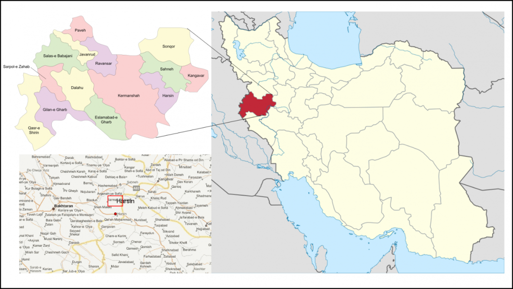
Harsin Dimension Stone Block is approximately 110 km2 in a distance of 30 km east of Kermanshah and 5.2 km north of the city of Harsin. Access to this block is possible through the Kermanshah-Harsin road and within 30 km along the east-south east.
Geographic location and access routes to Harsin
The unidimensional 5-yard exploratory zone is limited to the south of the city of Harsin, from the west to the villages of Chehr and Solaimaniyeh, to the north to the village of Aliabad and to the east by several small villages.
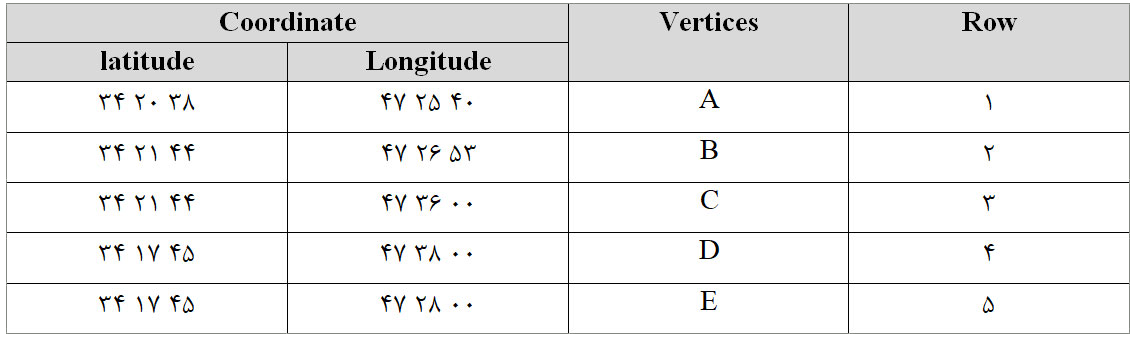
The coordinates of the Harsin exploration zone based on the coordinate system Lat/Lan (WGS1984
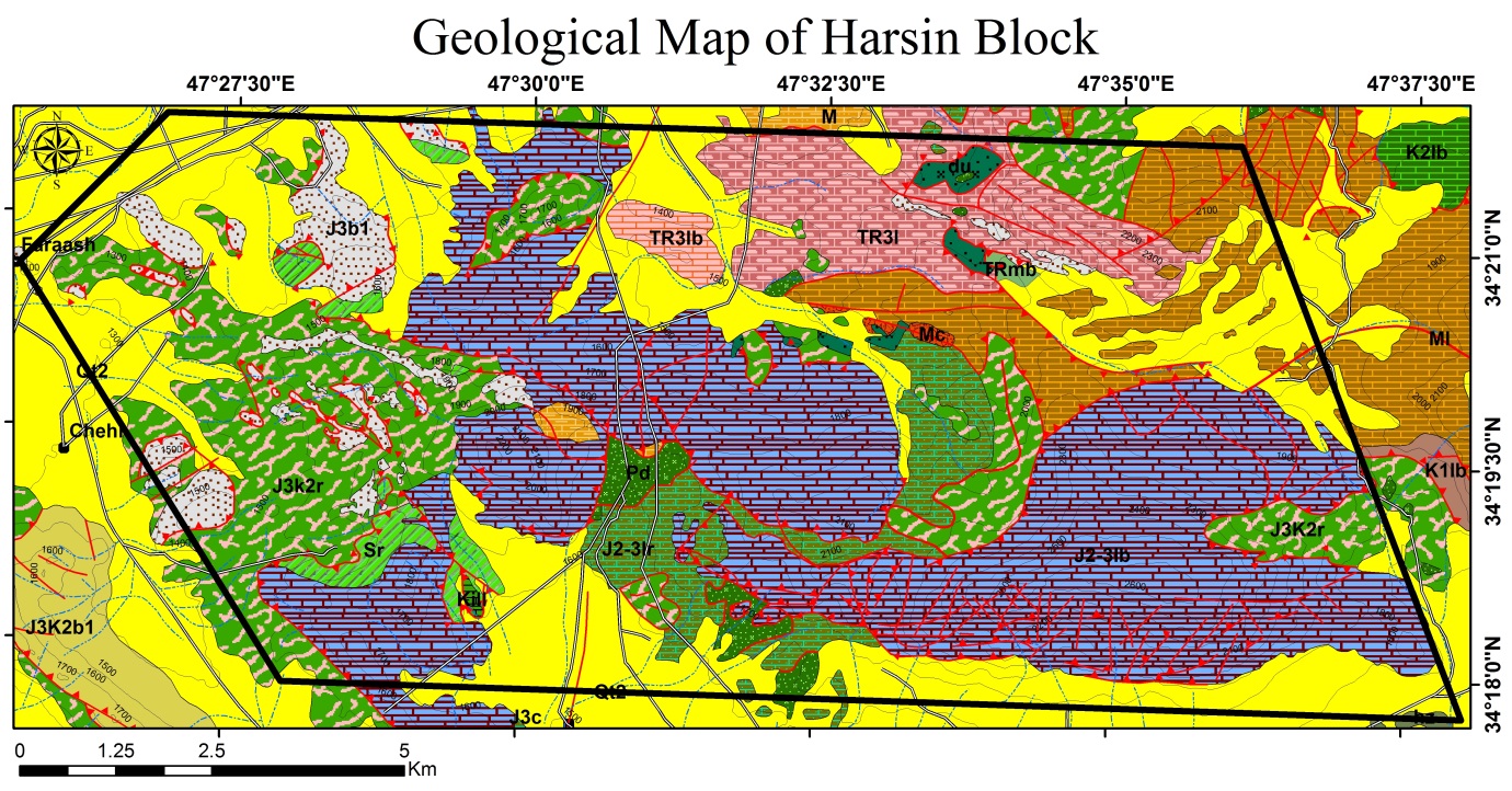
The Harsin block is located geographically within the Zagros orogeny zone, which consists of various rocky parts of the Sanandaj-Sirjan and Zagros zones of the folded and driven. Major units exposed in the exploratory zone include brown to gray oolitic lime in conjunction with
intergranular conglomerate (J2-3lb unit), light gray thin layers of oolitic lime (TR3l unit), radiolarites alternates red to purple and pelagic limestones (unit J3K2r),bioclastic lime with integrated conglomerate (J2-3ir unit), serpentinitis and serpentinized harbor germs (Sr units), and so on.
List exploration efforts made in the block of exploration Harsin is as follows:
- Compilation of all basic information including basic geological information, topographic maps, digital layers of lines and faults, records area, satellite imagery, …
- Processing information gathered in the form of information layers in the GIS system.
- Define field control points.
- Survey field control points.
This post is also available in: Persian